Showing posts with label road. Show all posts

Sunday, 21 February 2016

On the Road Again (Västergötland, July 2015)

A ‘problem’ with taking lots and lots of  photos on your summer holiday trip is that afterwards it gets so hard to choose which ones to blog, that you never get round to it…

On the other hand, it makes a nice change when you suddenly remember these photos in the dreariness of late winter.

On the non-existing third hand, however, you may then realize that you no longer have any idea what exactly you’re looking at!

But never mind… Let’s go back again to July 22, 2015…

Lake_Vänern_details

Our last stop was the lock at Brinkebergskulle, Vänersborg.
We are now driving east from Vänersborg towards Lidköping.

The landscape south of Lake Vänern  is mostly flat, but with some ‘table’ mountains/hills adding a bit of drama to the scenery:

CIMG5612

Halleberg, with an average height of about 90 meters above Lake Vänern and the highest point 155 meters above sea level, is also Scandinavia's largest old hill fort, dating back to the 3rd and 4th centuries AD. It is now part of a large Ecopark area also including Hunneberg (another table mountain nearby).

CIMG5618

CIMG5619

CIMG5647

CIMG5650

CIMG5634

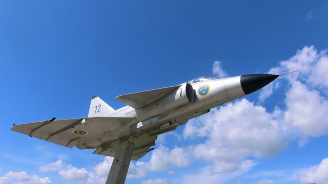
In the Middle of Nowhere (apologies to Grästorp municipality), there is a lay-by displaying a Viggen aircraft.

CIMG5635

CIMG5638

CIMG5641
A dilapidated old cottage (also in the middle of nowhere)

CIMG5644

I don’t remember what church this is – we did not stop here. This is a typical countryside view in these parts, though – quite a few church towers sticking up which can be seen from miles around - and many of them white.

CIMG5645

Here’s another church where we did stop to have a closer look - but I don’t remember where that was either…

2015-07-22_3

I’ll be linking this post to Mersad’s Through My Lens meme.

Monday, 10 August 2015

The Journey is the Goal – Trollhättan (1)

2015-07-20 thejourneyisthegoal

It’s amazing how long you can make a short holiday trip last, if only you make enough photo stops. (In case you feel you’ve lost track: After two weeks of blogging about it, I’m still only on Day 1 out of 4…)

If our aim had been just to drive straight from where I live to the town where we were to stay the next two nights, we could have done so in about 1½ hour. With all the various stops we made along the way, however, we took about 8 hours getting there…

Map picture

Trollhättan is situated on the river Göta älv. The steep water falls here used to be a huge obstacle for boats travelling the river between Gothenburg and Lake Vänern, until a lock system was built in the 19th century (the present locks still dating from 1916). In the late 19th century, the waterfalls were also “tamed” to produce hydropower, and to make the town a centre for heavy industries as well as for a national energy corporation.

Nowadays, the water is usually only let out into the falls for a few minutes daily in the summer season, as a tourist attraction.

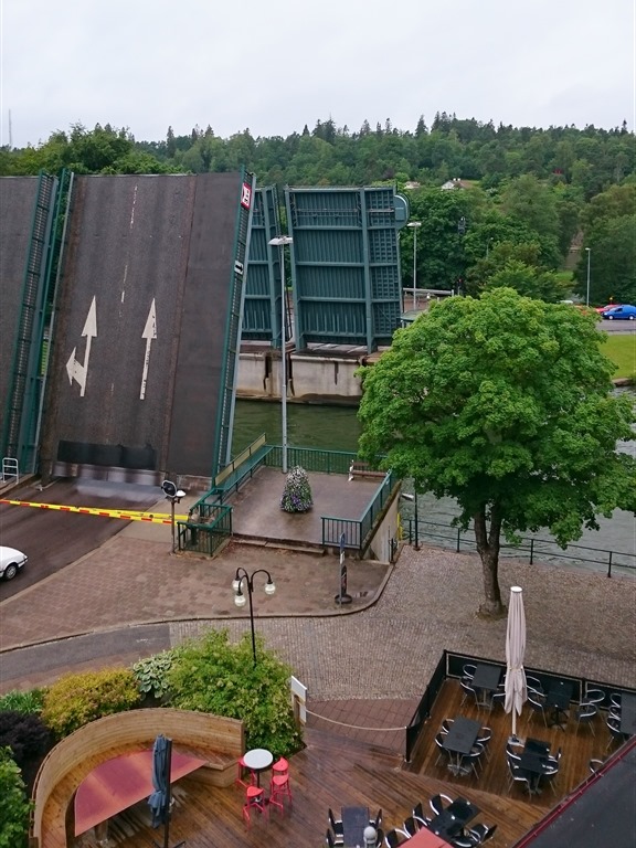
The first view I’ll show you, however, will be the one from my hotel room – which overlooked the bascule bridge across the river/canal:

2015-07-20--21 klaffbron

CIMG5461-001

My room was on the top floor to the left above the restaurant.

zDSC_0226-001

zDSC_0227-001

Linking to Mosaic Monday and Through My Lens

Related Posts Plugin for WordPress, Blogger...