Tuesday, 13 May 2014

Ancient History

CIMG9381-001

Another bus stop where I may choose to get off the bus on my way out to The House is right next to this old iron age grave field. (On the panorama view below you can see how close to the road it is.)

CIMG9395-001

Observant readers might wonder if this is the same field as in my “Landscape” post above. No, it’s not. That field is another 500 m or so down the road (and across the river).

CIMG9385-001

CIMG9386-001

The sign at the site says:

This archaeological site consists of two stone circles (“judgement rings”), three raised and two lying stones. The circle of widely spaced stones derive their popular Swedish name (a fairly recent invention) from the belief that they were meeting points of the Thing – a mixture of law court and parliament – but excavations have shown them to be burial places.

The grave-field was the burial ground of a neighbouring farm in the Iron Age. The dead were usually cremated and the bones placed in earthen vessels or wooden boxes along with ornaments and tools.

CIMG9393-001

CIMG9392-001

CIMG9394-001

Friday, 9 May 2014

FMTSO: Landscapes of My Town

CIMG5270

CIMG8438

Borås was founded along a river, the industries making use of the water in various ways; but the landscape on both sides is quite hilly.

It’s not really easy to get a good perspective of that in photos, though. And no matter how I tag my photos on the computer, the tags never seem to match the themes that the FMTSO team come up with! [sigh & smile]

DSCN7316-1

A photo taken some years ago – view looking east/ south east from one of the top floors of the hospital; which is in turn situated on the top of a hill.

DSCN7319

Walking down from that hill westwards towards the town center. Keep your eye on the church tower.

CIMG8669

Looking back up at the same church from below, still walking downhill towards the town center.

CIMG4772

From the west end of the Town Park. The church tower sticks up well above the horizon, and yet the church is really only like half way up the hill… Where did the hill go? One of the mysteries of perspective, I suppose. (I never really thought about that until now!)

CIMG8584

View looking south west from a bridge over the railway near the central station.

CIMG4926-001

This lake stretches from the north edge of the town to the village where my parents lived. This view is from the beach nearest to our house (not quite at the furthest end of the lake); looking south-west towards town.

There are several smaller lakes in the vicinity of the town as well. (Sweden is a country of many lakes.)

CIMG9132CIMG9113

… And there are woods …

CIMG4001

… and farmland …

CIMG1149

… and ancient monuments, like stone circles and grave fields dating back to “B.C.” …

Obviously, people found this a good area to settle down in even thousands of years ago.

Friday My Town Shoot Out

Thursday, 8 May 2014

A Whiff of Nostalgia

When I take the bus out to The House (as I did last Sunday), I can choose between two or three different stops where to get off (to walk the rest of the way).

CIMG9274-001

One is close to this dilapidated old kiosk; which hasn’t served as such for decades. It’s really a bit of a mystery why it has been left standing at all. But seeing it brings back some childhood memories.

Whenever we visited my grandparents (living in The House back then), grandma used to give my brother and me some money to go up to the kiosk and buy ourselves some sweets.

 2014-05-04 country road

The narrow dirt road leading towards my goal looks much the same still – even if the houses along it (including ours) have changed appearance since then. Straight down towards the railway… turning left along the deep ditch that separates the road from the rails… and then just a walk path at the end. Somewhere in the hedge is a narrow opening, leading into our back garden.

CIMG9299-001


Tuesday, 6 May 2014

A Stroll Around the Mall

CIMG9255

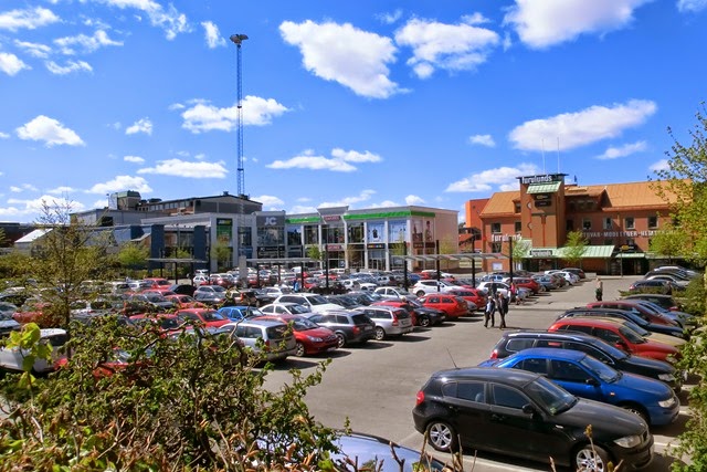
On Sunday, thanks to sunny weather, I was able to combine a trip out to our House in the countryside with an errand to the Big Mall across town in that direction – and a stroll around with the camera while waiting for the bus out of town.

CIMG9264

CIMG9256

Florist’s display at the entrance

CIMG9257-001

Two photos from inside the main mall

CIMG9260-001CIMG9261-001    CIMG9263-001

“Mall Wall” art… Perhaps inspired by the zoo, which is located at this end of the town as well.

CIMG9266-001

An old house across the street from the main mall stands out - purple is a very unusual facade colour. (The name and sign suggests that it is a “new age” kind of giftshop; I’ve never been inside.)

CIMG9267-001

Looking south from the bus stop. The red complex in the background to the right is the town’s big sports arena; rather new.

CIMG9271-001

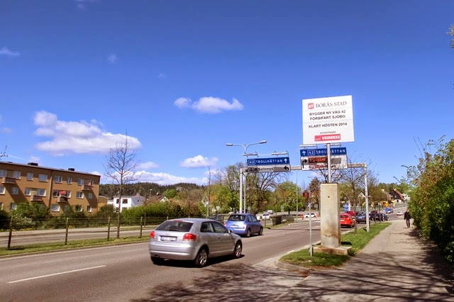
Looking north. The white sign gives information that a new bypass road project is going on (to lead the traffic out of town a bit more smoothly).

CIMG9269-001

Just near the bus stop where I stood waiting, there is a memorial stating that the original road was constructed in 1921-22 as an emergency relief project financed by the government.

Related Posts Plugin for WordPress, Blogger...