"On the road" ... somewhere in Skåne

Typical landscape for Skåne, the southernmost province of Sweden.


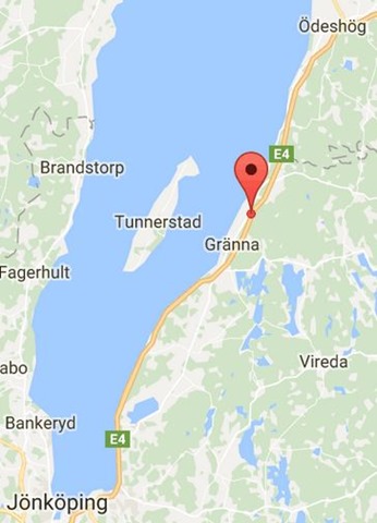
The ruins of Brahehus Castle are located 3 km north of Gränna on the east shore of Lake Vättern. The ruins sit 270 m above sea level and 180 m above the lake, providing a panoramic view of the lake and the island of Visingsö. The castle was built for Count Per Brahe the Younger* in the 1640s, but abandoned by the 1680s and suffered a fire in 1708. The castle ruin is near the modern E4 highway and is a popular tourist destination.
*Count Per Brahe the Younger (1602 – 1680) was a Swedish soldier, statesman, and author. He was a Privy Councillor from 1630 and ~ Lord High Steward from 1640 (the most important member of the privy council, also acting as regent during a minority or absence of the king/queen).
▲Brahehus as it would have looked back in the mid 1600s▼
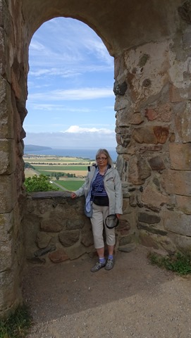
The views are still fantastic, and we were there on a beautiful morning.
Ferries to and from the island Vingsö in the lake.
There is another castle ruin on the island, but we did not go out there on this trip.
Geographically and chronologically, this post should come before yesterday’s…
I decided to shift them around for “thematic” reasons,
as I wanted to link these views to

Borås was founded along a river, the industries making use of the water in various ways; but the landscape on both sides is quite hilly.
It’s not really easy to get a good perspective of that in photos, though. And no matter how I tag my photos on the computer, the tags never seem to match the themes that the FMTSO team come up with! [sigh & smile]
A photo taken some years ago – view looking east/ south east from one of the top floors of the hospital; which is in turn situated on the top of a hill.
Walking down from that hill westwards towards the town center. Keep your eye on the church tower.
Looking back up at the same church from below, still walking downhill towards the town center.
From the west end of the Town Park. The church tower sticks up well above the horizon, and yet the church is really only like half way up the hill… Where did the hill go? One of the mysteries of perspective, I suppose. (I never really thought about that until now!)
View looking south west from a bridge over the railway near the central station.
This lake stretches from the north edge of the town to the village where my parents lived. This view is from the beach nearest to our house (not quite at the furthest end of the lake); looking south-west towards town.
There are several smaller lakes in the vicinity of the town as well. (Sweden is a country of many lakes.)
… And there are woods …
… and farmland …
… and ancient monuments, like stone circles and grave fields dating back to “B.C.” …
Obviously, people found this a good area to settle down in even thousands of years ago.